Can you fly your drone in New Zealand?
Whether you can fly depends on your drone, your registration and exactly where you fly. Here is what applies: key rules, no-fly zones and the official sources, in one place.
Regulator
Civil Aviation Authority of New Zealand
Framework
Civil Aviation Rules Part 101 + CATI 101-1 (in force 22 Dec 2025) + Part 102 (certified operations)
Pilot credential
Part 101 Pilot Qualification
KEY RULES
- Maximum height is 120 m (400 ft) above ground level, unless flying under the specific conditions set out in CATI: 101-1 section 2.5 (Part 101).
- No drone registration is required under Part 101. No licence is needed for standard daytime flying, but night flying and flying within 4 km of an aerodrome require approved training or a qualification (CATI 101-1).
- Keep the drone in visual line of sight with your own eyes at all times and fly below the cloud base. FPV is only allowed with a trained and competent observer who keeps the drone in sight and is in direct contact with you. Beyond visual line of sight is only allowed in a fully enclosed area the drone cannot escape (CATI 101-1, 2.9).
- Stay at least 4 km from the boundary of any aerodrome, including helipads. Flying closer requires an approved drone pilot qualification (or direct supervision by a holder) — an Australian CASA RePL or a Part 61/149 pilot licence also counts — plus ATC authorisation via AirShare at controlled aerodromes, or at uncontrolled aerodromes the operator's agreement, an observer and max 400 ft. Shielded operations outside the boundary, max 33 ft (10 m) above the shielding object and behind a barrier that would stop the drone, are exempt (CATI 101-1, 2.3).
- In controlled airspace you need an ATC clearance (request via AirShare) unless it's a shielded operation. Do not fly in restricted areas or military operating areas without permission from the administering authority, and never fly in low flying zones (Part 101.7, 101.9). They are shown on AirShare.
- Get consent from the owner or occupier before flying above any property — private or public (e.g. council parks, beaches, lakes).
- Stay at least 150 m horizontally from any point directly above a marine mammal (whales, dolphins, seals) when operating below 600 m above sea level (Marine Mammals Protection Regulations 1992).
- Flying on conservation land (national parks, reserves, forest parks) requires a permit from the Department of Conservation (DOC). Check DOC's drone zone map: green-zone recreational permits are issued instantly online and valid for one year; orange and red zones are reviewed case by case.
- Night flying only indoors, as a shielded operation, or after a CAA-approved night training course — with lighting showing the drone's orientation, one drone at a time, and a 30-minute shielded night refresher if you haven't flown at night in 90 days (CATI 101-1, 2.11).
- Do not fly over people without their consent
- Give way to all manned aircraft at all times
- Maximum drone weight is 25 kg under Part 101; drones of 15–25 kg need an approved airworthiness inspection and competency assessment. Heavier drones, or operations outside Part 101, require Part 102 certification.
No-fly zones and restrictions

Frequently asked questions
Do I need a licence or certificate to fly a drone in New Zealand?
In New Zealand, the credential to know about is the Part 101 Pilot Qualification. Whether you need it depends on your drone's weight and how you fly — Civil Aviation Authority of New Zealand runs the scheme, and the official sources below spell out exactly when it applies.
Can I fly a drone as a tourist or foreign visitor in New Zealand?
Yes — no drone registration and no pilot licence for standard daytime flying, tourists included; flights at night or within 4 km of an aerodrome need approved training or a pilot qualification. The catch is consent: get permission from the landowner or occupier and anyone you fly over. DOC conservation land (about a third of the country) needs a paid permit. Rules for foreign pilots can change, so always double-check with Civil Aviation Authority of New Zealand before you travel, and see the official sources below.
What are the most important drone rules in New Zealand?
The short version: Maximum height is 120 m (400 ft) above ground level, unless flying under the specific conditions set out in CATI: 101-1 section 2.5 (Part 101). On top of that: No drone registration is required under Part 101. No licence is needed for standard daytime flying, but night flying and flying within 4 km of an aerodrome require approved training or a qualification (CATI 101-1). Also: Keep the drone in visual line of sight with your own eyes at all times and fly below the cloud base. FPV is only allowed with a trained and competent observer who keeps the drone in sight and is in direct contact with you. Beyond visual line of sight is only allowed in a fully enclosed area the drone cannot escape (CATI 101-1, 2.9). These are central aviation rules — location-specific airspace, land, nature, privacy and photography requirements can also apply in New Zealand, so always check the official sources.
Where am I not allowed to fly a drone in New Zealand?
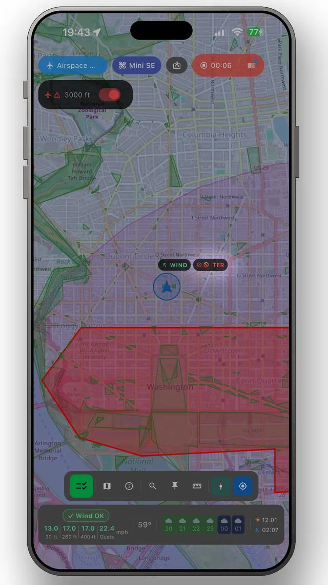
What you need to avoid are the restricted zones — typically around airports, prisons, military areas and protected nature areas. You'll find the official map for New Zealand under Sources below, and the DroneKoll app shows current NOTAMs (temporary airspace restrictions) for New Zealand.
Who regulates drone flying in New Zealand?
Drone flying in New Zealand is regulated by Civil Aviation Authority of New Zealand. The airspace itself is managed by Airways New Zealand. You will find both organisations' official pages under Sources below — those are the links worth bookmarking.
Good to know
OFFICIAL SOURCES
- CAANZ — Drone rulesOfficial Civil Aviation Authority drone rules and guidance for New Zealandaviation.govt.nz
- AirShare — Airspace mapReal-time airspace map with controlled zones, flight requests and alertsairshare.co.nz
- DOC — Conservation land permitsApply for a permit to fly on Department of Conservation managed landdoc.govt.nz
ADDITIONAL RESOURCES
Always check official CAANZ sources before flying. This page is a guide — not a legal authority. Rules may change without notice.
The app
The whole picture, up to date — in your pocket
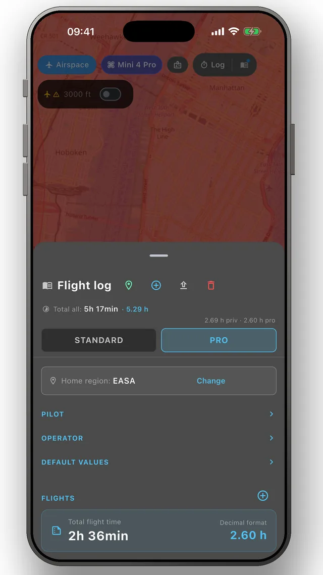
DroneKoll shows weather and current NOTAMs on the map — with a flight log and checklists built in.
More in the app:Interactive zone map · Flight log · Planning & measuring · Pre-flight checklists · Flying abroad