The app
The map that answers: can I fly a drone here?
Official zones, current NOTAMs and pilot weather on one map — tap a spot and see exactly what applies there, in your language.
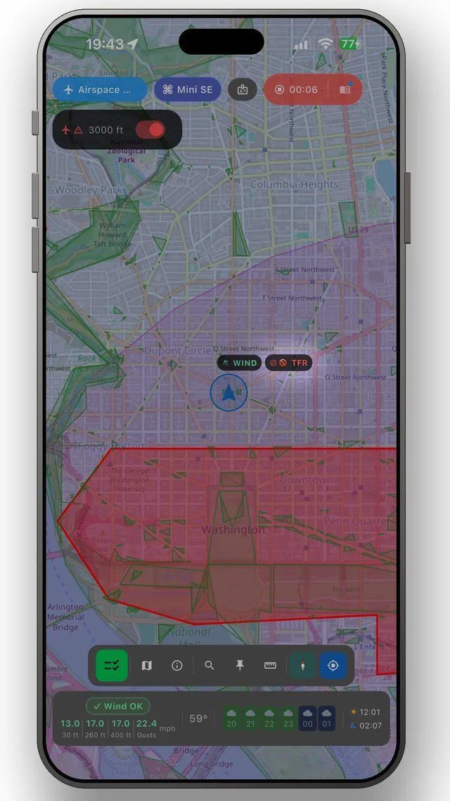
- Official no-fly zones and restrictions from 19 countries' aviation authorities
- Current NOTAMs — temporary restrictions appear as they are issued
- Pilot weather in the map bar: wind at altitude, gusts, precipitation and daylight
- Flight warnings on your lock screen while you fly
- Rules for 55 countries, 27 languages — the map travels with you
Frequently asked questions
Where am I allowed to fly my drone?
Open the map to see what applies around you: restricted areas, airport zones, nature protection and temporary NOTAMs — sourced from official aviation authorities.
Does the map show temporary restrictions (NOTAMs)?
Yes — NOTAMs are fetched in real time for supported countries, so temporary restrictions show up alongside the permanent zones.
Which countries does the zone map cover?
19 countries have full official zone overlays, 36 more have current NOTAMs, and every one of the 55 supported countries has verified rules and official sources.
The app
The whole picture, up to date — in your pocket
DroneKoll shows interactive zone maps for 19 countries and NOTAMs for 55 — with rules for all 55, plus weather, flight log and checklists built in.
More in the app: Interactive zone map · Flight log · Planning & measuring · Pre-flight checklists · Flying abroad